In today’s rapidly evolving aviation landscape, accurate, high-quality airport mapping is essential for safe, efficient, and compliant operations. At KEYVAN Aviation, we offer cutting-edge Airport Mapping Solutions designed to transform raw aerodrome data into a fully digital, precise, and compliant format that meets international standards.

Why Digital Airport Mapping Matters
Our solutions enhance operational efficiency, improve navigation accuracy, and ensure seamless regulatory compliance by converting complex, static aerodrome data into dynamic, interactive digital datasets.
Our Expertise in Airport Mapping
KEYVAN Aviation provides advanced digitalization services for aerodrome mapping, covering:
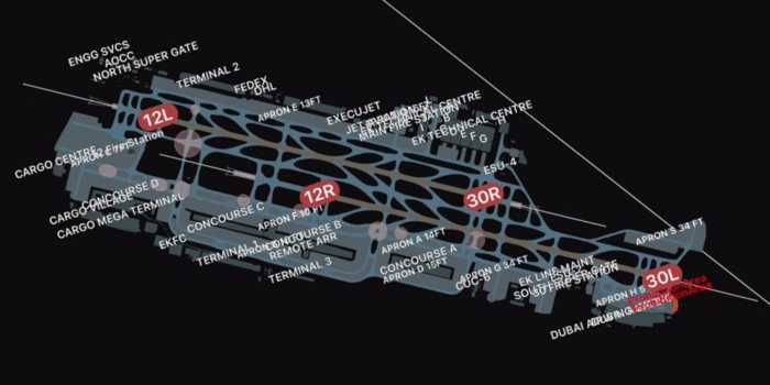
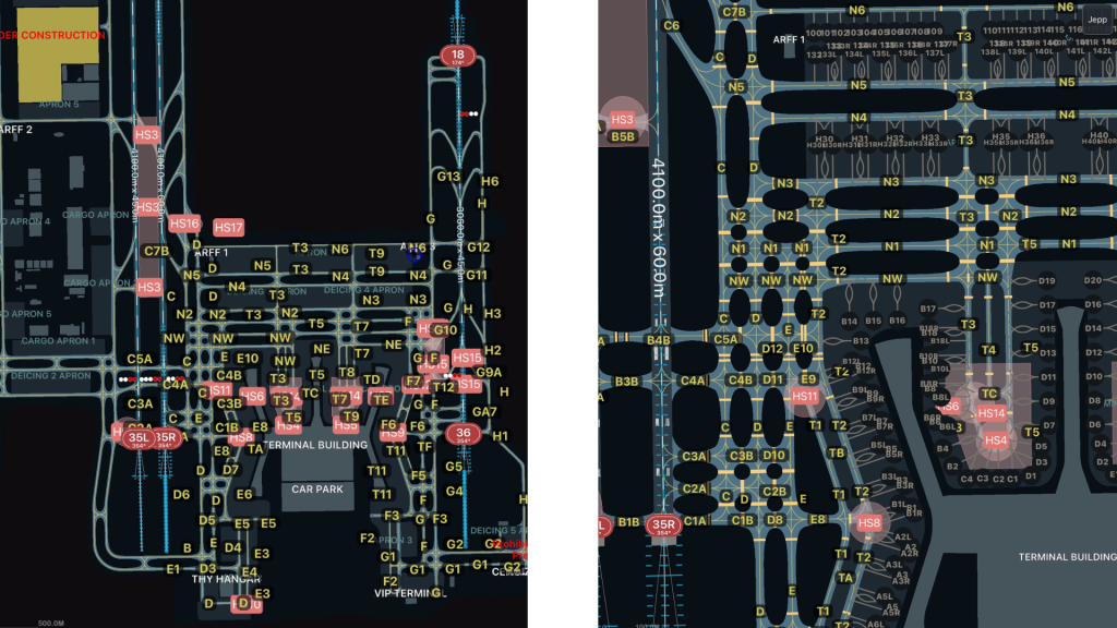
- Runway, Taxiway & Apron Mapping – Detailed layouts for optimized ground movements.
- Obstacle & Terrain Data – Accurate representation of vertical obstructions for enhanced flight safety.
- Aerodrome Geospatial Data – High-resolution GIS-based maps ensuring spatial accuracy.
- Satellite Imagery Integration – Combining real-world imagery with digital aerodrome data.
- Regulatory Compliance – Adhering to ICAO Annex 15, PANS-AIM, EASA, FAA, and GACA standards.
Seamless Integration with Global Systems
We ensure full interoperability with aviation data platforms, including AIXM 5.1.1 AMDB datasets, enabling seamless use across:
- Aerodrome Operations – Ground handling, emergency response, and maintenance planning.
- Air Traffic Management (ATM) – Enhanced navigation and obstacle awareness.
- Drone & UAM Operations – Supporting next-generation air mobility with detailed infrastructure data.
The Keyvan Aviation Advantage
- EASA & FAA-Certified Data Provider – High standards in data quality & compliance.
- Advanced GIS & AI-Driven Processing – Cutting-edge technologies for accuracy & efficiency.
- Proven Track Record – Trusted by leading aviation authorities worldwide.
For more information, contact our team at: navdb@keyvan.aero